

Digital Surface Models (DSM) and Digital Terrain Models (DTM) are top-down 2D representations of a 3D scene as an image with each pixel encoding both geographical coordinates as well as the elevation at that coordinate. They are often referred to as 2.5D representations of scenes. The DSM is a natural heightmap derived directly from a 3D point cloud while DTM is a bare-earth view with some natural (eg. trees, bushes) and all man-made features (eg. buildings, vehicles) removed, effectively depicting the “terrain” of the surveyed area.
DEMs are commonly used in geographical mapping, urban planning, powerline inspection, terrain inspection, and in the gaming industry. While all of this can also be accomplished using a 3D point cloud or a mesh, analyzing a 3D representation is a more resource intensive task. On the other hand, DEMs can be analyzed like raster images in common (and often free) GIS software, like QGIS. They can be converted into other useful raster like aspect and slope maps, contours, or viewed as a hill shade representation to view features more prominently (These functionalities are all available in QGIS).
DSMs are used in:
- Urban planning to understand how the height of one object affects others.
- Power line corridor inspection
- The telecom industry to understand how cell phone coverage can be affected by geographical and man-made features in the area.
- DSMs make it easy to model canopy heights of trees in an area. The difference between the surface model and the terrain model effectively shows the canopy height.
- Stockpile measurements which are used frequently in the mining industry.
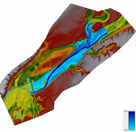
- Flood inundation modeling to understand the effects of flooding in a particular area and on important structures such as streets, buildings, roads, and railways.
How are bare-earth DTMs generated?
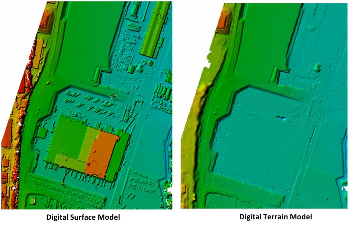
The first step in generating a DTM involves an accurate classification of a 3D point cloud and identifying the various features present in it. Non-ground features (like trees, cars, buildings, etc.) are identified and then removed from the point cloud, and an elevation model is created from a top-down view.
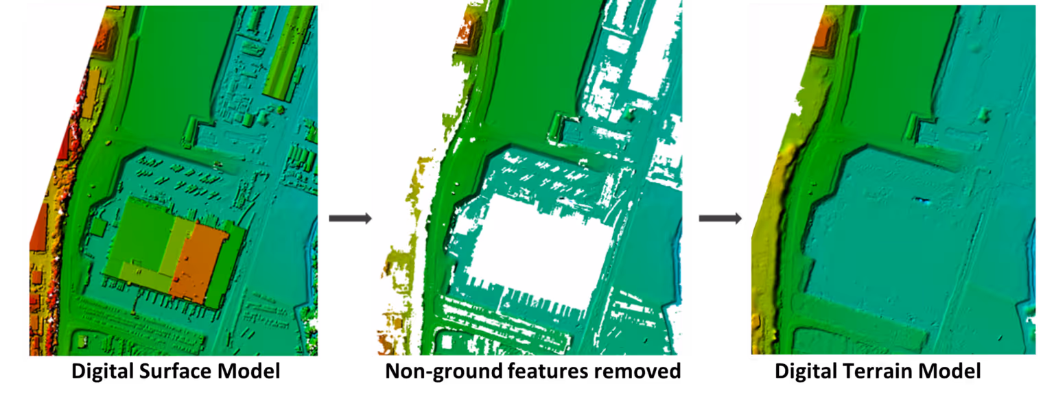
A smooth surface is then interpolated over the deleted area using the elevation of pixels around it. This is commonly done using algorithms like Triangulated Irregular Network (TIN), Inverse-Distance Weighting (IDW), or Krigging.
Use cases of DTMs:
- In infrastructure projects to understand the bare terrain slope to prevent building structures on steep slopes
- Soil science and creating physical models of terrains
- In geology to understand the terrain topology of an area and to get insights into tectonic plate boundaries
- Land-use planning and analysis
- Understanding the hydrological flow direction of rivers for disaster management studies
- Contouring topographic and relief maps
Algorithms segmenting the 3D point cloud have to be robust enough for accurate identification of the ground plane (and in effect the non-ground features) so that the interpolated model accurately depicts bare-earth terrain of the surveyed areas. Inaccurate classifications can lead to noisy DTMs which in turn can affect critical decision-making processes. Consequently, manual editing of classified point clouds before DTM generation is a common practice in the industry. This is unfortunately a time-consuming and resource-intensive process.
Recent advances in 3D deep learning have enabled such robust classification of ground and other features with a much higher accuracy than classical methods. Some seminal works in this field include DGCNN and PointNet++.
Building upon such advances, we at Preimage have developed an efficient and agile 3D point cloud classification, DSM and DTM generation workflow. You can try it out for free directly from our web application (no installation needed) by uploading your RGB point clouds.
What are you using DSMs and DTMs for? Got any thoughts on this blog post? We would love to hear from you. Shoot us an e-mail at hello@preimage.ai or drop us a message through our contact form.


.webp)